Archive · Maps & Geography
The Map of the Pannonian Sea - Reconstruction
Millions of years ago, parts of Central Europe were under the Pannonian Sea. Here's the map of the Pannonian Sea and the reconstruction of its area.
Introduction
Around 10 million years ago, a large water surface existed in what is now known as the Pannonian plain. This surface, called the Pannonian Sea (later known as the Pannonian Lake), covered most of present-day Hungary, Croatia, parts of Serbia, Slovenia, Bosnia and Herzegovina, Slovakia, Czechia, Austria, Romania, and even Ukraine.
Pannonian Sea disappeared around 600 000 years ago, but its remnants are still visible in the region. Fossils and other geological clues tell us the story of a long-lost sea that once occupied large parts of Central Europe.
Although the Pannonian Sea disappeared around 600 000 years ago, it was not a short-lived sea. It lasted for about 10 million years (although the sources on this duration differ - some claim that the sea lasted for over 30 million years, and it should be observed within the context of Pangaea, a super-continent). The Pannonian sea existed during the Miocene and Pliocene eras. It was a relatively shallow sea whose depth never exceeded 1000 meters, with an area of roughly 200,000 square kilometers. Pannonian sea went through three phases - from being a salty sea to the brackish lake (once it lost its connection to the much larger Paratethys Sea due to the uplift of the Carpathian Mountains) and finally ending up as a fresh-water swamp until it completely dried up and disappeared. Thanks to the varied conditions and changing salinity levels, remarkably endemic fauna developed in the Pannonian Sea.
Why did the Pannonian Sea dry up?
As mentioned earlier, during a Miocene era, a mountain range of the Carpathian Mountains started its uplift. Gradually, this uplift isolated the Pannonian Sea from the rest of the Paratethys Sea. This process ended around 10 million years ago. Cut off from the Paratethys Sea, the Pannonian Sea began its millions years-long process of drying up and vanishing. It completely disappeared around 600 thousand years ago.
Maps of the Pannonian Sea
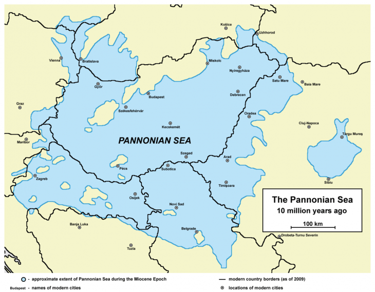
Wikipedia Maps
Wikipedia displays several different maps of the Pannonian Sea. They offer an excellent overall picture of the Pannonian sea extent. However, I wanted to create a more detailed map of the Pannonian Sea. I started with the maps from Wikipedia and traced them on top of the present-day countries and geographical features.
I started with this map.
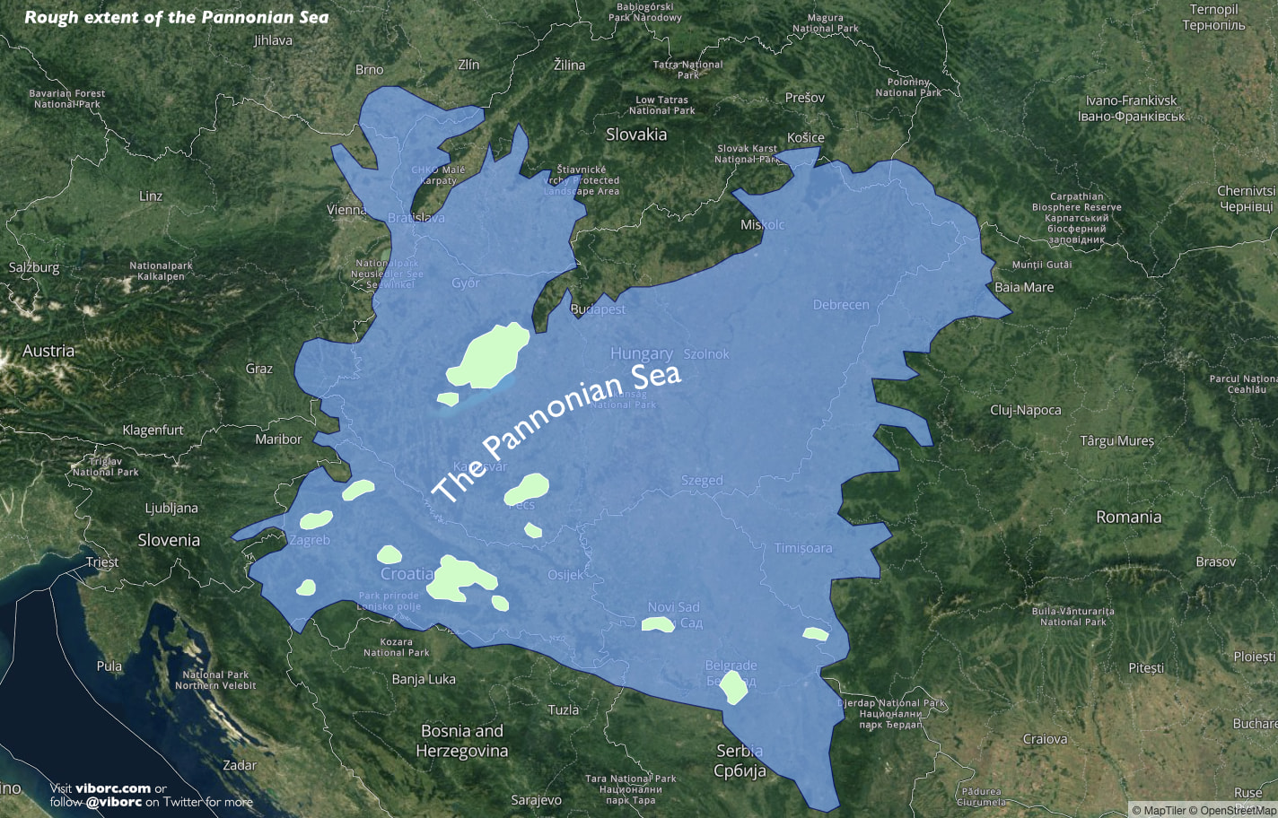
Then I worked my way down and made an overlay on top of the present-day satellite imagery. This was the result.
High-resolution map of the Pannonian Sea
We know, without any doubt, that the Pannonian island mountains existed, and precious fossil remnants help us determine a rough idea of the sea level at one point. Mountains like Papuk, Psunj, Medvednica, Fruška Gora, and Mescek (in Croatia, Serbia, and Hungary) were islands, and rich flora and fauna was present. There are fossils of sharks, countless fish, and crustaceans found on the shores of these former islands.
I used the Flood Map tool and started increasing the sea-level to try and get the resemblance of the possible extent of the Pannonian Sea. The result is the map I'm sharing here with you.
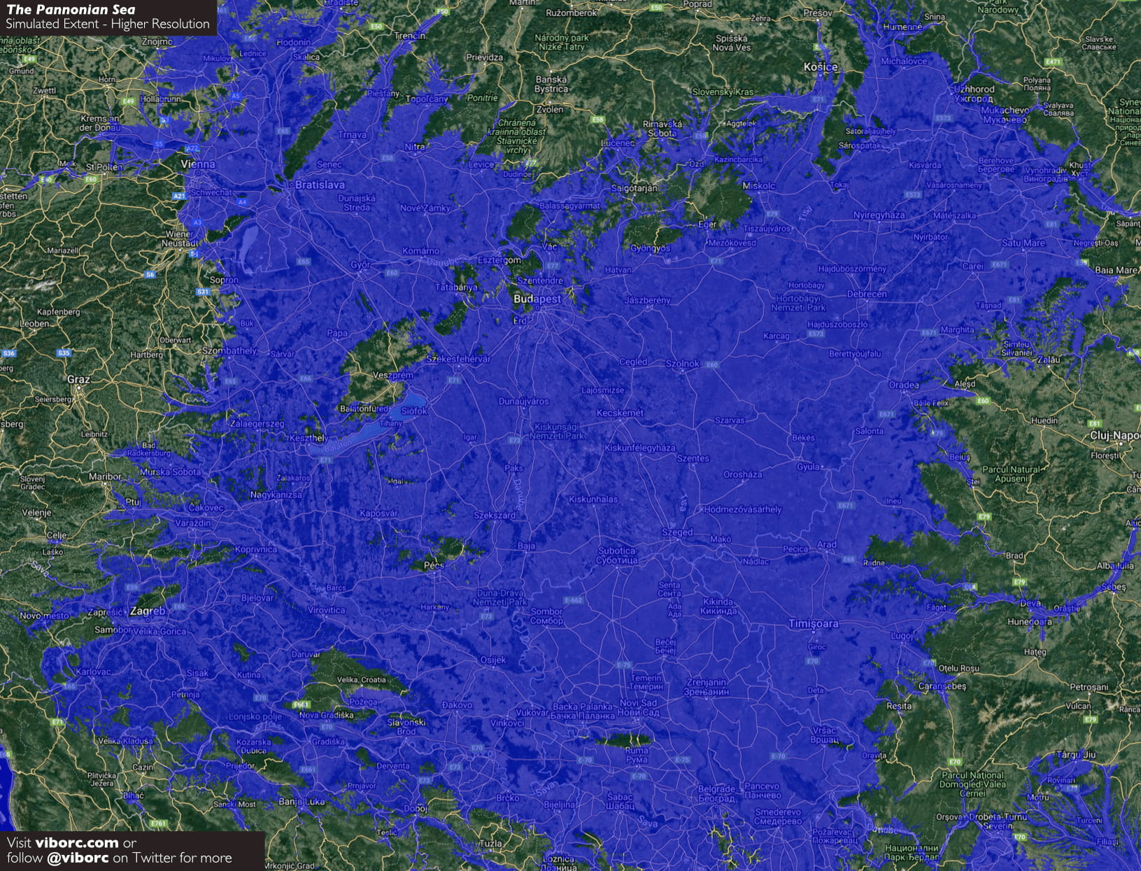
While it cannot be considered strictly and scientifically accurate, it gives a solid understanding of the Pannonian Sea and Pannonian Lake extent. It is astonishing to think that most of the present-day Hungary and continental Croatia were below the sea level for quite some time.
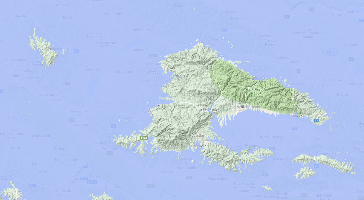
Take a look at some close-ups.
Islands of Slavonia - Papuk, Dilj and Moslavacka gora
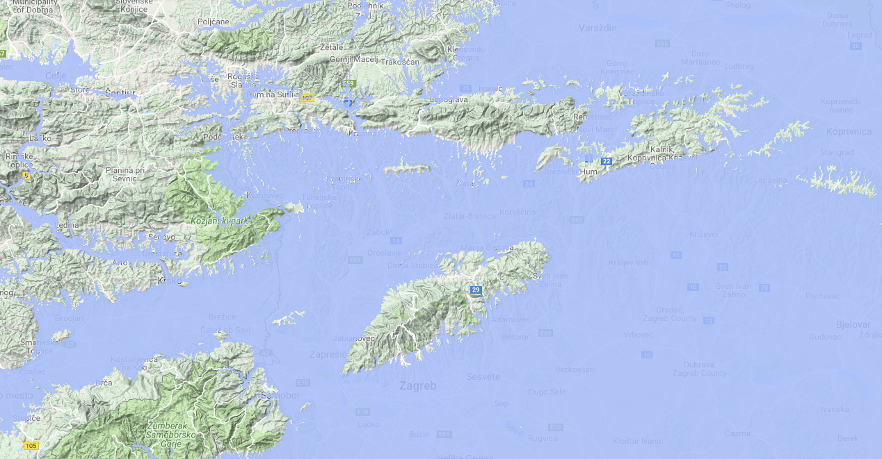
Zagreb and Slovenia Archipelago
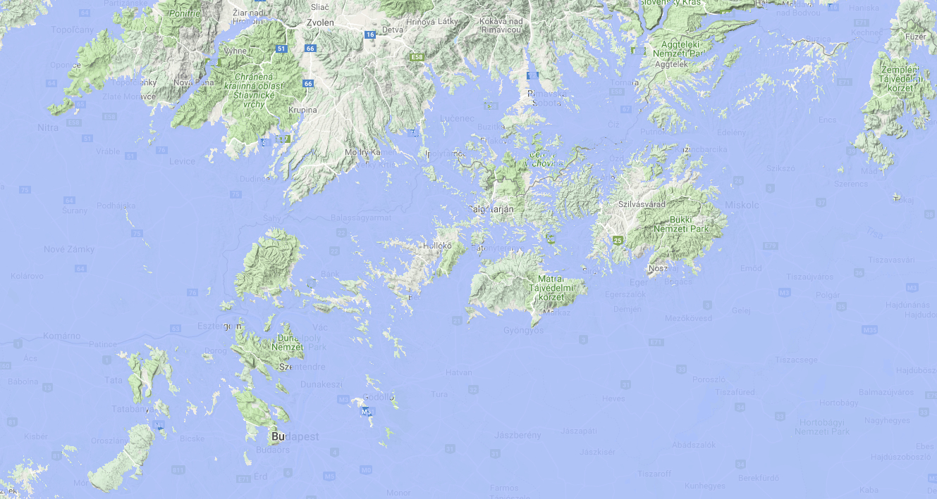
Budapest Riviera
Unfortunately, there are no Daruvar or Pecs Rivieras today, but luckily, the beautiful Adriatic Sea is not that far away, and most of the Central European nations, once being submerged under the Pannonian Sea visit it every summer.
Maps are from Google Maps, MapTiler, and OpenStreetMap. Copyright of the map data and imagery belongs to those copyright holders.