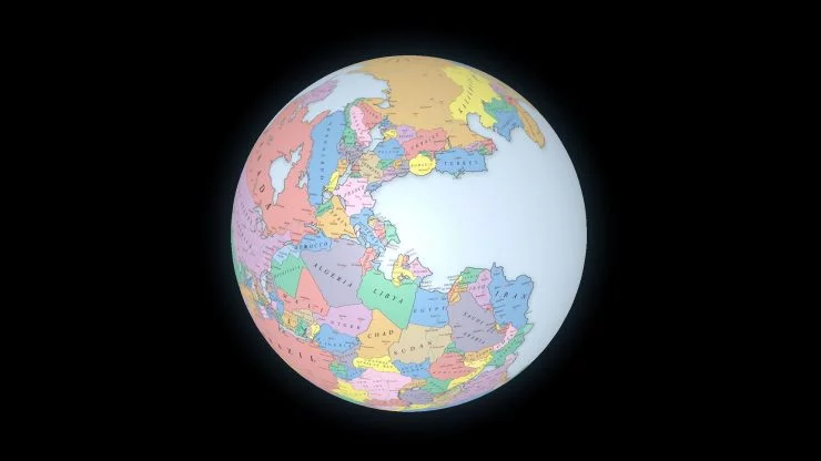
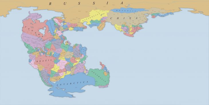
The map at the end of this post shows a reconstruction of the supercontinent Pangaea (also called Pangea) with present-day borders and an interactive 3D visualization of a globe so you can explore it in more detail.
Massimo Pietrobon created the original map, and with some modifications, it was transformed into an equirectangular projection, making it suitable for 3D projection on a globe.
What is Pangaea?
Around 300 million years ago, the supercontinent Pangaea (or the supercontinent Pangea) started its development. It was made up of earlier larger continental units like Gondwana, Euramerica, and Siberia. It started breaking apart 100 million years later, some 200 million years ago.
The name Pangaea comes from the Ancient Greek pan (meaning all, entire) and Gaia or Gaea (meaning land, Earth, or even Mother Earth).
Our world is a dynamic place, which holds for such fundamental events as the formation of continents and ocean masses. Plate tectonics offers incredible insights into how our planet came to be and what its future might look like.
During history, the large supercontinent Panagea broke into numerous pieces – each of which eventually became a part of a plate of the lithosphere. Those pieces, our continents, are still in motion and are responsible, among other factors, for earthquakes.
But if we travel enough back in the past, we’ll get to a point where most of the land mass was crumbled together as continents were once joined.
The origin of Pangaea – continental drift hypothesis
In the early 20th century, Alfred Wegener, a German climatologist, geophysicist, and polar researcher, developed his theory of continental drift (or a continental drift hypothesis).
Essentially, the hypothesis revolves around the idea that the Earth’s continents have moved around during its past. The movement was relative to each other, effectively “drifting” across the ocean bed. Although this was on the right track, continents are not drifting as the more complex mechanic of plate tectonics is involved.
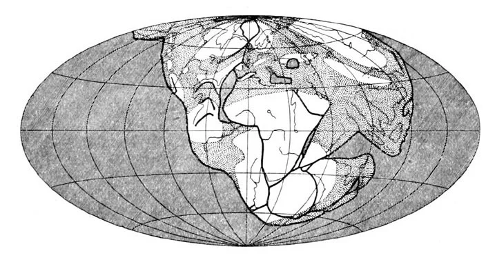
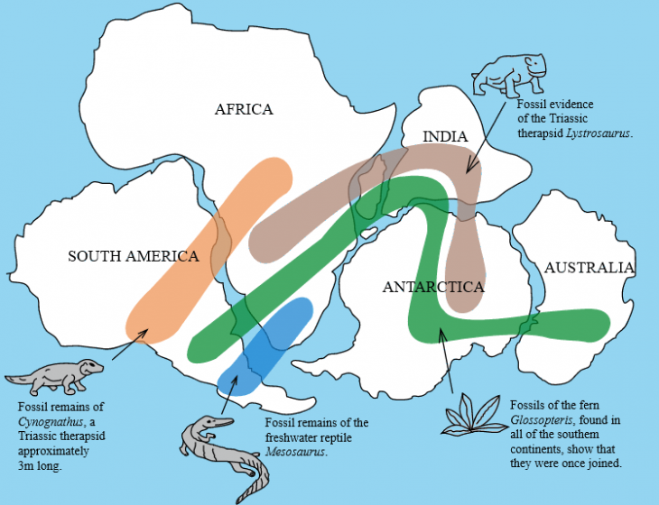
Wegener used the map shown above to illustrate his Panagea concept. Although somewhat simplistic, it was an important step in the right direction toward developing a fully scientific theory supporting the existence of such a supercontinent.
Evidence of existence
Although Wegener established his continental drift hypothesis, he was not the first person to postulate that ancient continents were once joined.
As early as 1596, Brabantian cartographer, Abraham Ortelius, suggested that the seemingly close fit of North America and South America on the one side of the Atlantic Ocean and Europe and Africa on the other was not just a coincidence.
And you can observe additional evidence through the distribution of fossils across the continents and the continuity of mountain ranges (mountain chains).
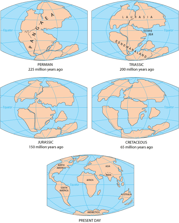
Pangaea break-up
However, over time, Pangaea started breaking up. The process is still ongoing from the early Permian period (some 225 million years ago) until today.
The map of Pangaea on a 3D interactive globe
As mentioned earlier, the initial map was created by Massimo Pietrobon back in 2012. However, during that time, he created an updated map to reflect scientific facts better and published it in 2016. A cleaned-up version of his Pangaea map with political borders is here.
Click on a map for a high-resolution view.
3D interactive globe of Pangaea
Thankfully, the new map projection was equirectangular, making it suitable for a projection on a 3D spherical surface.
And that’s what you are looking at right now – an interactive, 3D globe of our planet Earth some 300 million years ago with one supercontinent – Pangaea.
Click around, zoom in ,and zoom out, give it a spin. And see where your country was approximately located on Pangaea.
Here’s how you can support viborc.com
We hope you like our content. You can support us in several ways. If you use ad-blocking software, please consider adding us to a safelist. When sharing our content, please link back to the source. When sharing on Instagram, please tag @viborccom. The same is for Twitter (@viborccom).
Thanks! Hvala! Danke! Дякую!
ABOUT THE AUTHOR
